Location

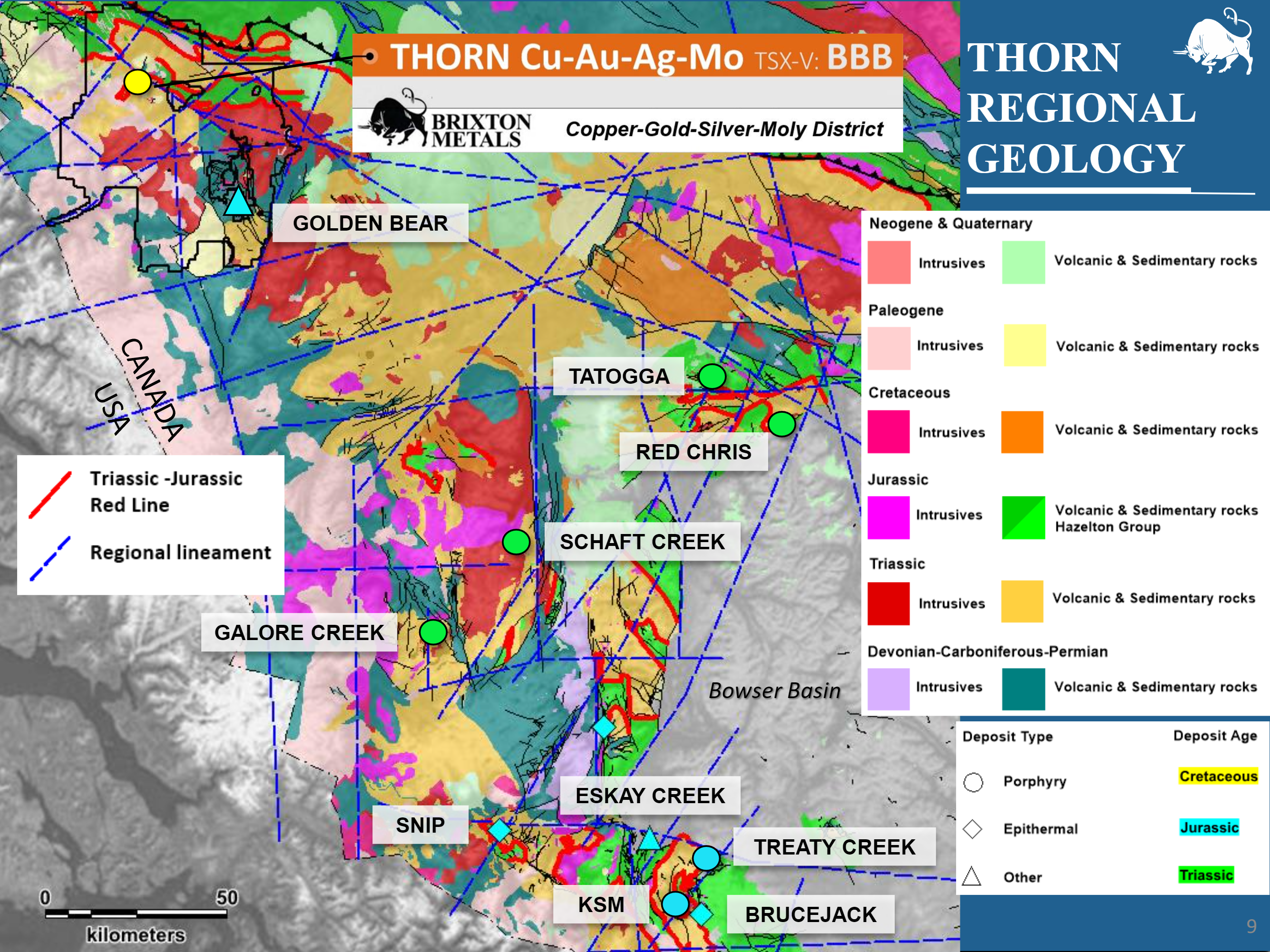
Geology
Geology here is defined by volcanic and sedimentary rocks of the Stikine tectonostratigraphic terrane, intruded by Triassic to Eocene volcanoplutonic rocks.
![]()
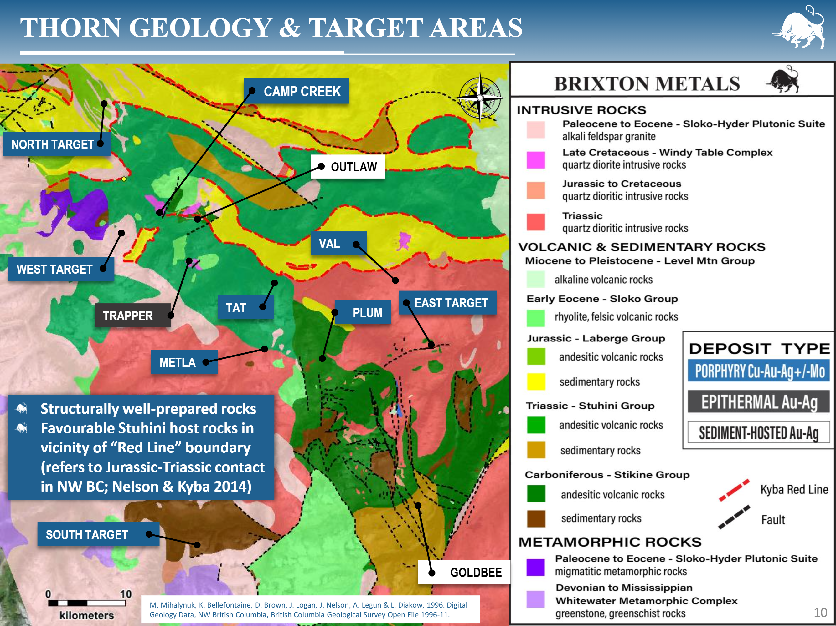
Geology at the Thorn Project is defined by volcanic and sedimentary rocks of the Stikine tectonostratigraphic terrane, intruded by Triassic to Eocene volcanoplutonic rocks. In this region, the Stikine arc is composed of the Stuhini and Laberge Groups. The Stuhini Group is a Late Triassic island arc sequence comprised of massive submarine andesite and pillow basalts overlain by the Sinwa Formation, which are deep submarine clastic sedimentary rocks that shallow upwards, with increasing occurrences of limestone beds upwards. The Laberge Group is Early to Middle Jurassic in age and unconformably overlies the Stuhini Group. It is composed of 3-5 km of calcareous clastic sediments, including sandstone, conglomerate and shale. Multiple stages of subduction-related magmatism were emplaced at the Thorn Project during the Triassic, Jurassic, Cretaceous, and Eocene. At the Outlaw Zone, Jurassic-aged rhyodacite dykes are related to gold mineralization. The Golden Bear Mine gold mineralization is also Jurassic in age. The Camp Creek and Trapper mineralizing systems are Cretaceous in age. Zircon U-Pb Geochronology work at Metla indicates a Triassic-aged system.